CONSTRUCTION SERVICES

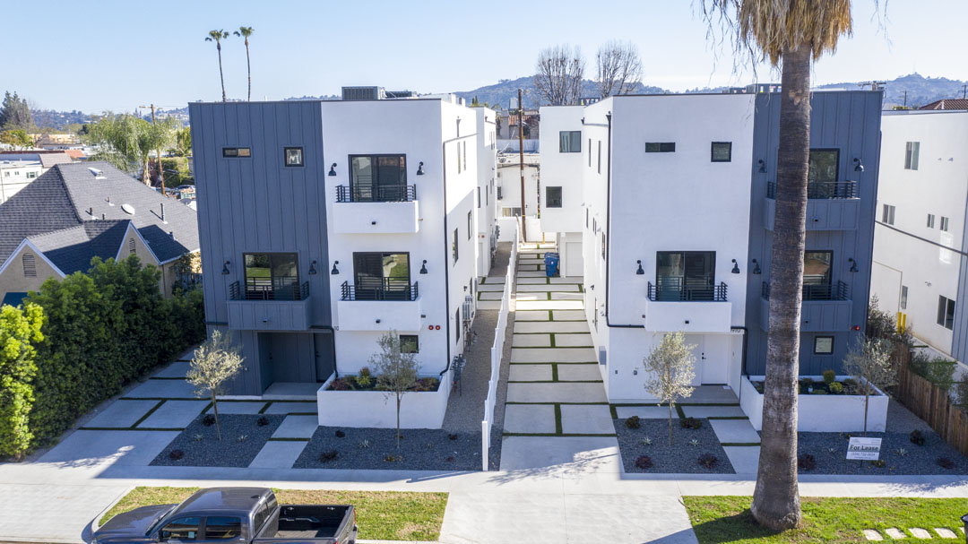
Aerial/ Surface Photography
Our team specializes in creating stunning video content that will help showcase your property, services, location, or company fleet. We understand how vital an online presence is, and our goal is to increase your visibility and reach your target audience.
Aerial/ Surface Videography
We offer beautifully edited videos that capture your unique story. We pride ourselves on our excellent customer service and attention to detail. Our goal is to provide you with a video that you will be proud to share with your family and friends.
2D/3D Aerial Survey Mapping
Mapping and modeling can help you accurately measure distances and plan your project, including cut and fill analysis. This can save you time and money by helping you avoid potential problems down the road.

Construction Progression Monitoring and Mgmt.
As construction projects move forward, it is crucial to monitor their progress in order to ensure that they are proceeding as planned. By doing so, potential problems can be identified and addressed in a timely manner. This, in turn, can help avoid costly delays and disruptions.

Panorama Photography (180 Degree View)
We create panoramic photos by stitching together multiple images to create a single, seamless 180-degree view. This allows our clients to get a fuller, more complete picture of their surroundings, providing them with a unique and comprehensive view.

Roof Inspections (coming soon)
Drones are an efficient, cost-effective, and safe way to conduct roof inspections. They can save time and money by providing a bird’s eye view of the structure as well as reducing unnecessary dangerous manned roof inspections.
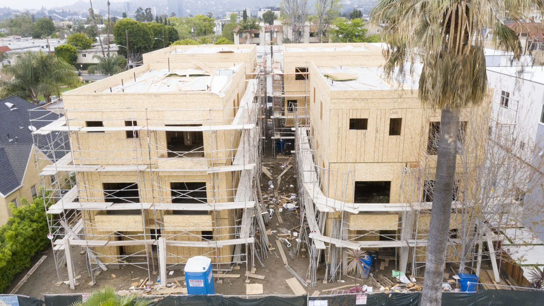
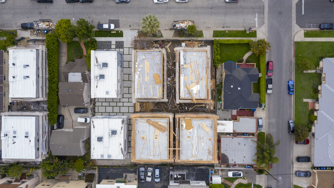
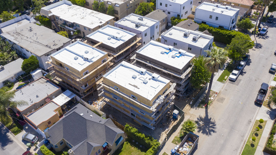
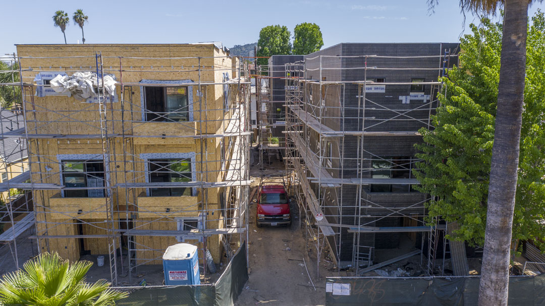
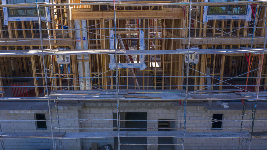
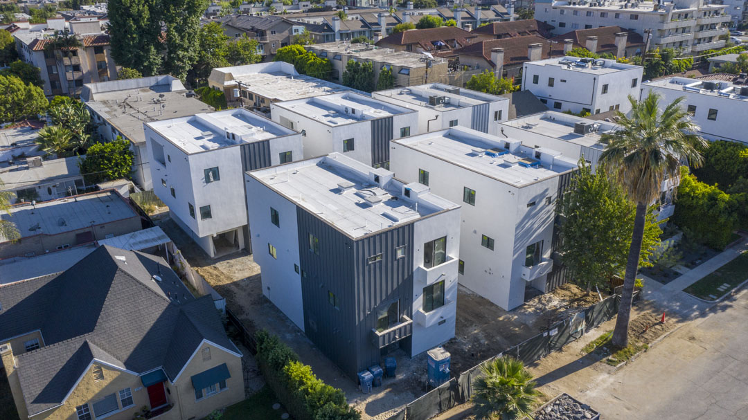
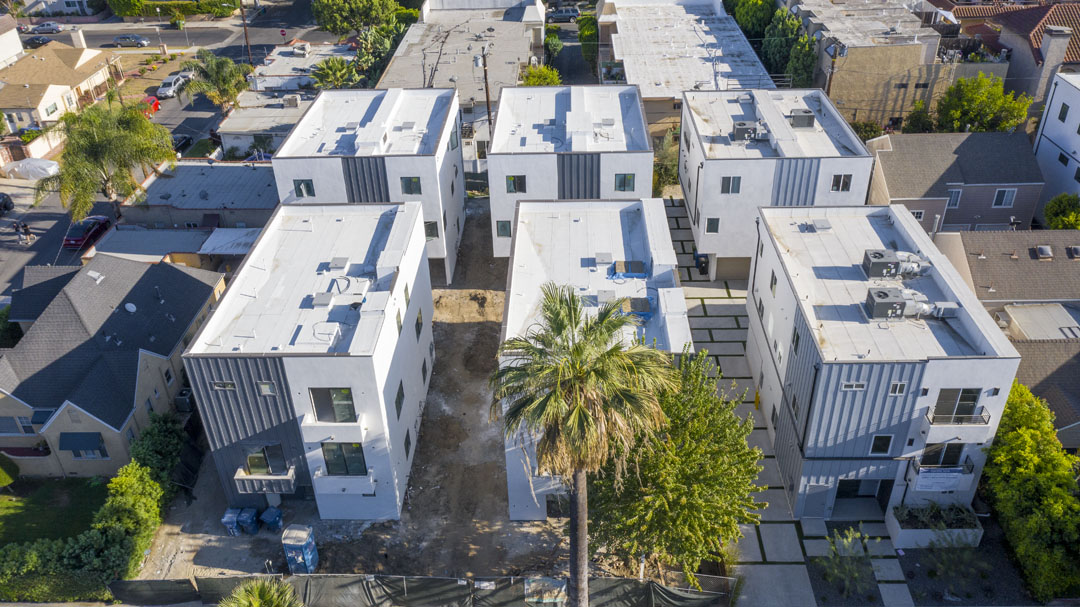
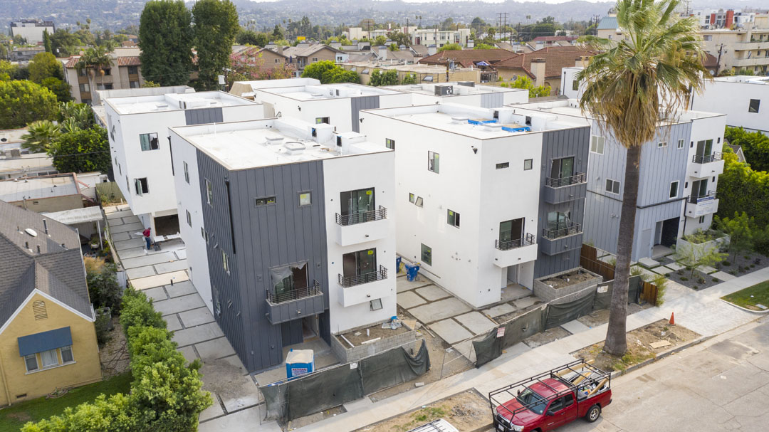
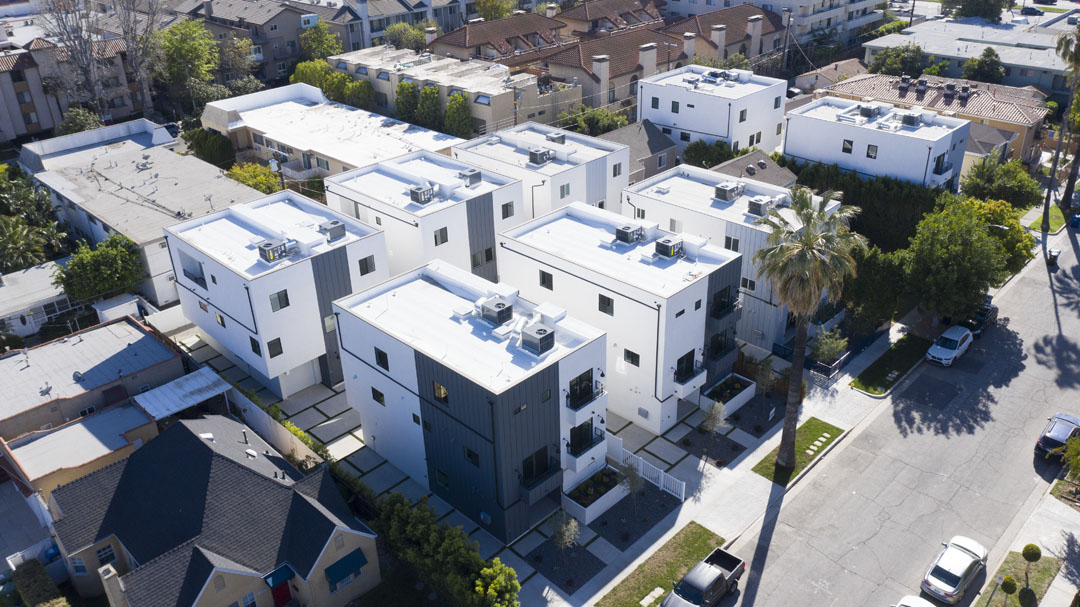
Construction Progress Monitoring Photography
Construction Progression Monitoring
Construction progression photography/videography is good for a number of reasons. First, it can document the construction process and show the progress being made. This can be useful for both the construction company and the client, (ie. potential structural flaws). Second, it can help to generate interest in the property. Finally, it can be used to create a portfolio of the construction site’s progress.
Video | Photography | 2D/3D Mapping
Mapping and modeling can help you accurately measure distances and plan your project, including cut and fill analysis. This can save you time and money by helping you avoid potential problems down the road.